Hello everyone!
Let me introduce myself, my name is Vladyslav Mokrousov, I am a second year student at software engineering department of Kyiv Polytechnical Institute, Ukraine. This summer I will be working on Google Summer of Code (GSoC) project for AerospaceResearch.net.
Please check my github and twitter.
This blog will briefly describe the goal of the project, and then will proceed to describe what has been done so far.
BigImage and BigGlobe Projection
During this summer I will work on creating software for visualization of satellite imagery, mainly images from NOAA satellites. The goal of the project, as my proposal states:
Current software provides possibility for decoding APT signals received by RTL-SDR receivers, but the task of understanding the extracted data is hard, because an open-source programs for proper visualization of these images do not yet exist. This project aims to create an open-source software to target that issue, so more developers and enthusiasts will receive an efficient tool to help them in their research. The software would provide functionality for creating different types of interactive visualizations of satellite weather images, along with their georeferencing.
Particularly, I am working on software, which will combine many satellite images into one big picture (BigImage). The software will handle cases of overlapping images using different merging strategies. Another main task of the software will be to provide accurate image georeferencing [1].
Image georeferencing
Image georeferencing refers to the process of associating image coordinate system with geographical coordinate system, i. e. each pixel of the image will be paired with certain geocoordinates. This will allow combining these images with maps or with each other.
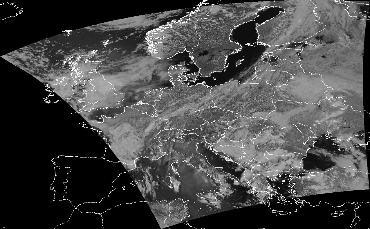
Figure 1. Georeferenced image combined with map.
An example above shows how the georeferenced image can be used for visualization. The process of georeferencing is divided in two parts:
- Computing set of Ground Control Points (GCPs).
- Fitting the image to match these GCPs.
To compute GCPs we will use the TLE file, which describes the orbit parameters of the satellite. Using pyorbital module we consistently calculate the position coordinates of satellite and match them with relative position of pixels on the image. The 2 part is carried out by gdal [2] library, which is called via it’s Python API.
Performance
The aim for created software is to produce visualizations of big amount of image data, therefore the implementation should be fast and should handle memory expensive cases. To satisfy this requirement gdal library is used. It is an open source software designed for raster and vector data manipulations. gdal is written in C++, that’s why it is extremely fast. Manual memory management ensures the efficiency of memory use. The implementation makes use of gdal Python bindings, which provide interface for using gdal functionality in Python.
Further work
Image georeferencing is the first step required to produce good looking projections of satellite images, especially for creating image overlays. In the next blog we will talk about map overlays and techniques for merging overlapping parts of NOAA images.